Thermal InfraRed (TIR) is commonly used in an aerial platform to find objects that are difficult to see using optical techniques for various reasons. These reasons and situations can include:
- Heat anomalies underground, in particular, spontaneous combustion (sponcom) in coal mining
- Feral animals as they can very difficult to stand out from the terrain in optical situations but find it difficult to mask their heat signature from a TIR camera
- Plants under moisture stress increase in heat signature so the TIR camera can be used as an aid to managing irrigation programs
- TIR techniques can be used in conjunction with other monitoring techniques to audit and survey energy usage and wastage
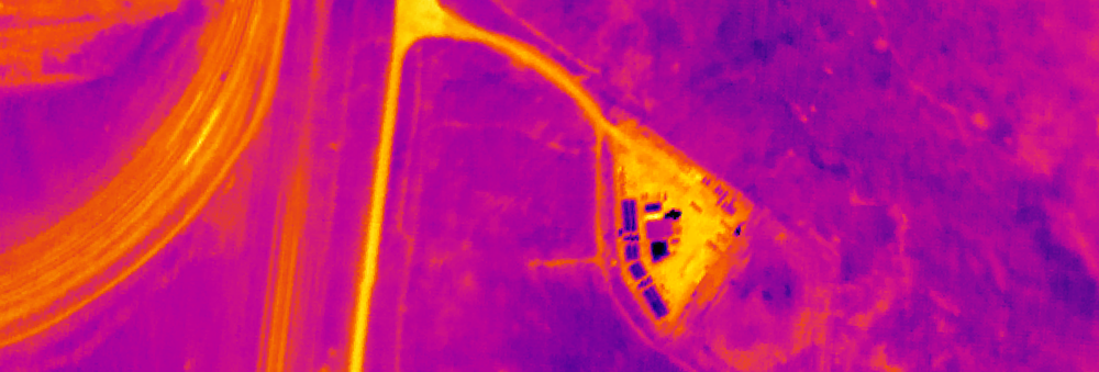
TIR is an imaging technique which uses cameras in the InfraRed range to gather data which directly shows the infrared signature of the terrain it is capturing. The important item to note is that the camera can only display heat which is radiated from what it is seeing. It cannot see around or through objects to hotter objects unless the “hidden” objects are transferring their heat signature to the object that is masking them.
TIR data can be supplied in a number of GIS suitable formats. It should also be noted that due to the technique of collecting the TIR data the imagery undergoes different geometric processing compared to other aerial data sets, due to the type of camera that is used to acquire the data. Therefore, in places the geometric quality of the data may be lower than other data sets. Consequently, the images provided should only be used for thermal interpretation and not generic mapping applications.